Coos Region...Adventure on Every Trail
Sunset Bay to Cape Arago--Saturday, January 19
Location and Time
Meet 9:00 am at day use parking lot, near volley ball courts and restrooms at south end of Sunset Bay. The short version of the hike will end at about noon, and the long version at 2:00.
Driving Directions: From Hwy 101 in downtown Coos Bay follow the signs 12.3 miles through Charleston to Sunset Bay State Park. Park in the day use parking lot.
Suggested Carpool sites and departure times:
- Coos Bay Visitor Center 8:15,
- Rays in Bandon— 8:00,
- Coquille Visitor Center—8:00,
- Dune Information Center in Reedsport—7:40.
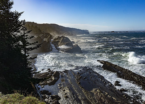
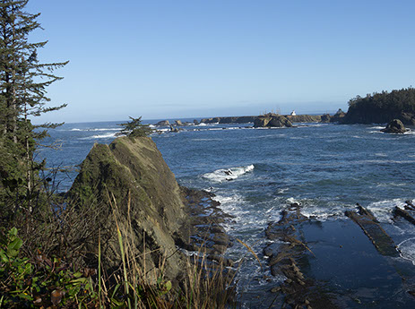
Hike Description: We will start at the Sunset Bay Day Use Area, and follow the trail to the headland, where we will walk along the bluff, with great views of the ocean. As we continue around the group campground, we'll descend to Norton Gulch, and then take the trail along the bluff to Shore Acres, viewing incredible sandstone formations along the way. The trail from Sunset Bay to Shore Acres is about 2 miles, and those desiring a shorter hike can turn around there (for a total of 4 miles).
The longer hikers will continue past Shore Acres to Simpson Beach, and then follow the Coast Trail to the Simpson Reef overlook, and then through the woods to Cape Arago. The whole trip to Cape Arago will be about 4.5 miles, one-way, with a shorter return, using the Cape Arago Highway.
Along the way to the Simpson Reef Overlook, we'll branch off on some lesser known trails that provide great views