Coos Region...Adventure on Every Trail
Sweet Creek Falls Hikes
Location and Time
Meet at Dune Information Center in Reedsport at 9:00
Directions: From Coos Bay Visitor Center in downtown Coos Bay travel 26.6 miles N on Hwy 101. Visitor center is on left directly opposite the turnoff for Hwy 38. We will leave from the Dune Information Center at 9:00 and reach the Sweet Creek Falls trail head at 10:30. Some gravel roads and deep pot holes are on our route but we will go easy.
Suggested carpool sites & departure times:
- Reedsport Visitor Center - 9:00,
- Public Parking north of Coos Bay Visitor Center—8:10,
- Rays in Bandon—7:40,
- Coquille Visitor Center—7:40,
- Battle Rock Park Visitor Center—6:50
Saturday, April 6
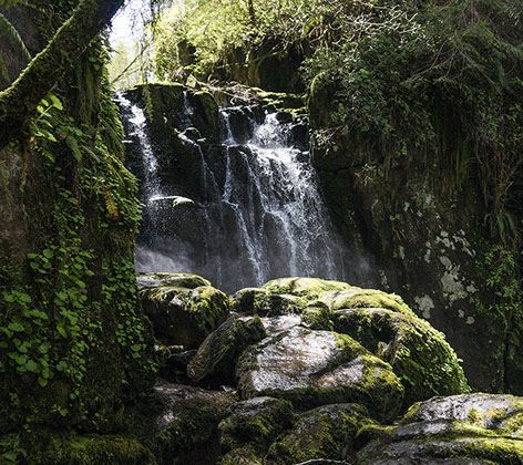
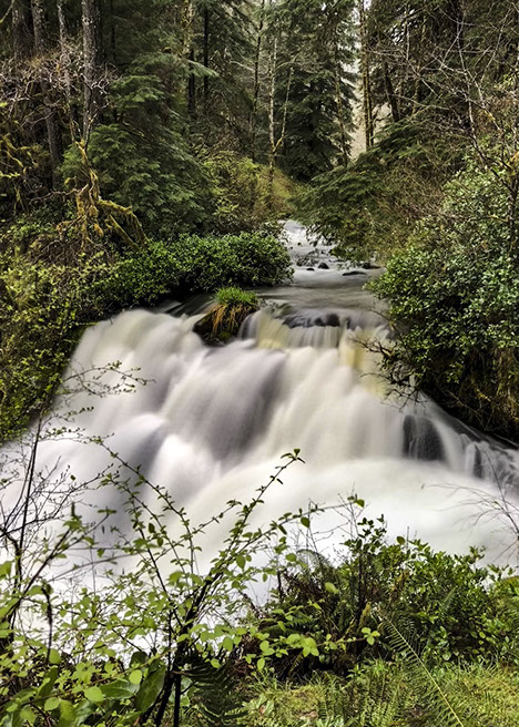
The Hikes: The Sweet Creek/Beaver Creek area offers hikers a smorgasbord mountain stream and waterfalls experience. There will be 4 different hikes all of which are out and back on the same trail and rated moderate.
The first will be a 1/2 mile trip to view Beaver Creek Falls.
The second will be a 1.2 mile hike to a different viewpoint of Beaver Creek Falls.
The third hike will be 1.6 miles to Sweet Creek Falls.
The final and best hike of the day will be a 1.6 mile hike along Sweet Creek on a trail that meanders along the water and actually travels right over the creek on a railed catwalks that is bolted to the side of the canyon.
Altogether, you will hike 4.9 miles for the day.
If you want to take it a little easier you can cut out the third hike and take a break while the rest of the group goes on this section. Since the hikes are all “out and back” you can cut any of the hikes short and return to the parking area if you are getting tired. Plan on 4 hours for all the hikes—starting for home around 2pm.
Bring lunch and water and rain gear, dress in layers, and wear sturdy waterproof boots.