Bandon
Notes about Bandon, OR
Category Archives: Landscape change
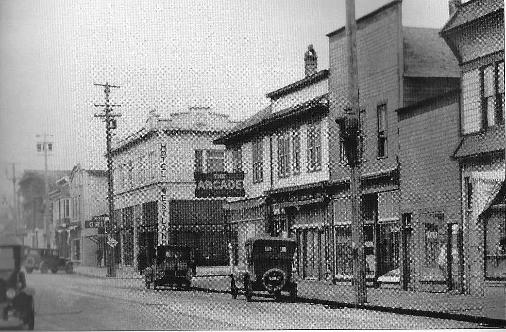
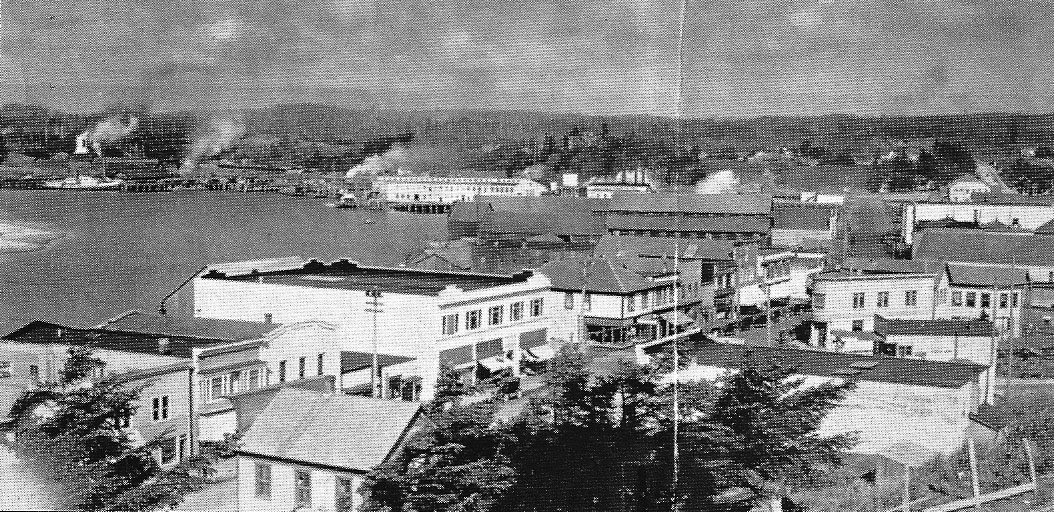
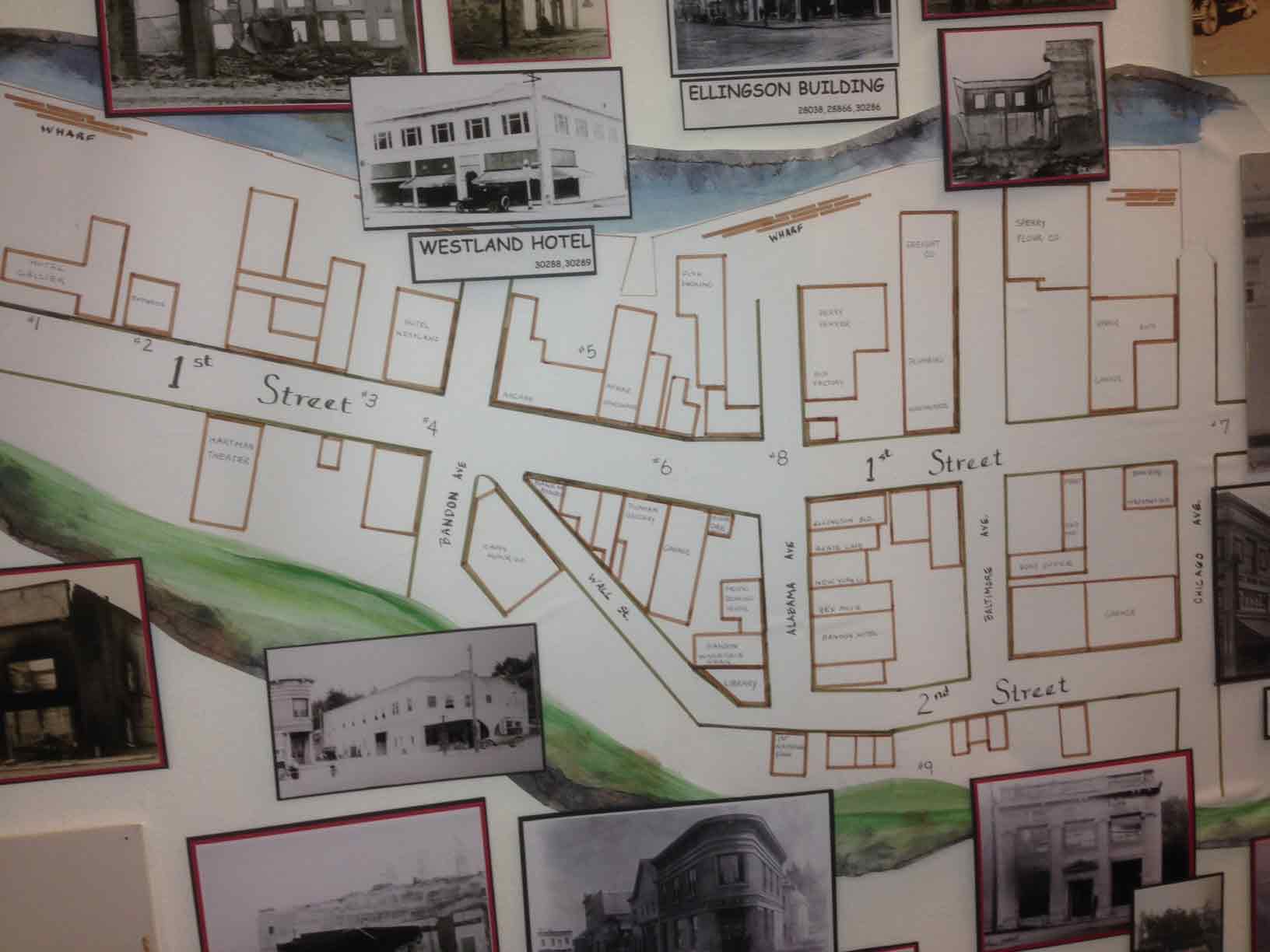
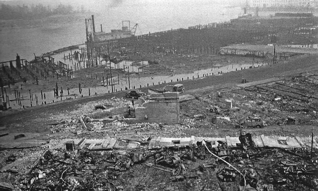
The Bandon Fire, 1936
No one is sure how the 1936 fire started, but the blame for the quick spread is gorse, a shrub that was brought in as an ornamental, but proceeded to spread everywhere…a truly invasive species. What started as a forest fire burning east of town spread quickly when the winds shifted, and when the fire hit the gorse, it was like someone has thrown gasoline on the fire. Flames rose high in the air, and nothing could stop them. Throwing water on it was like throwing water on a grease fire.
By the time the fire burned out, the town was flattened.
Here are two photos and a map showing buildings before the 1936 fire. The third photo shows the devastation after the fire. (note–all photos will open in a new window when you click on them)
For more information go to the Bandon History Museum Facebook page.
Changes in the Economic Profile of Bandon
Over time, a number of industries have come and gone. These photos show two of those industries, both related to agriculture.
One is a Nestle’s Milk Condensory. It took advantage of the dairy industry. Below is a photo it its early days.(note–all photos will expand to a new tab or window when you click on them)

Nestle Evaporated Milk Condensery
Both the reduction of the dairy industry and the fact that local farmers resisted selling to Nestle caused the business to fail. After that, a number of industries tried to make use the building, but it seems that none were very successful. Eventually, because it was built on pilings that began to rot away, the building had to be demolished. It’s interesting to note that this is one building that survived the great fire of 1936, only to fall victim to other forces.
The full history can be found in the Bandon Western World.

Condensery shortly before demolition
The other industry was the woolen mill. The number of sheep farms in the area provide a large supply of raw materials…for a time. As with the condensery though, the woolen mill wasn’t able to earn enough to survive, and another industry left Bandon.
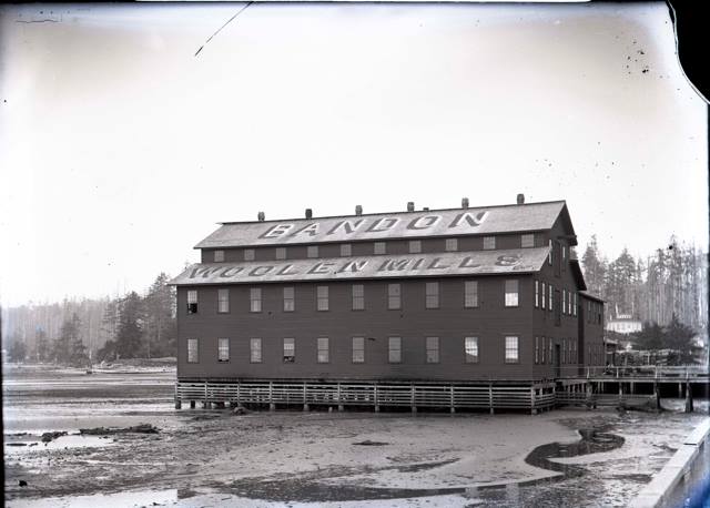
Woolen Mill
This view shows where the buildings above used to be. The waterfront is now fairly clear, but the pilings from the buildings remain.
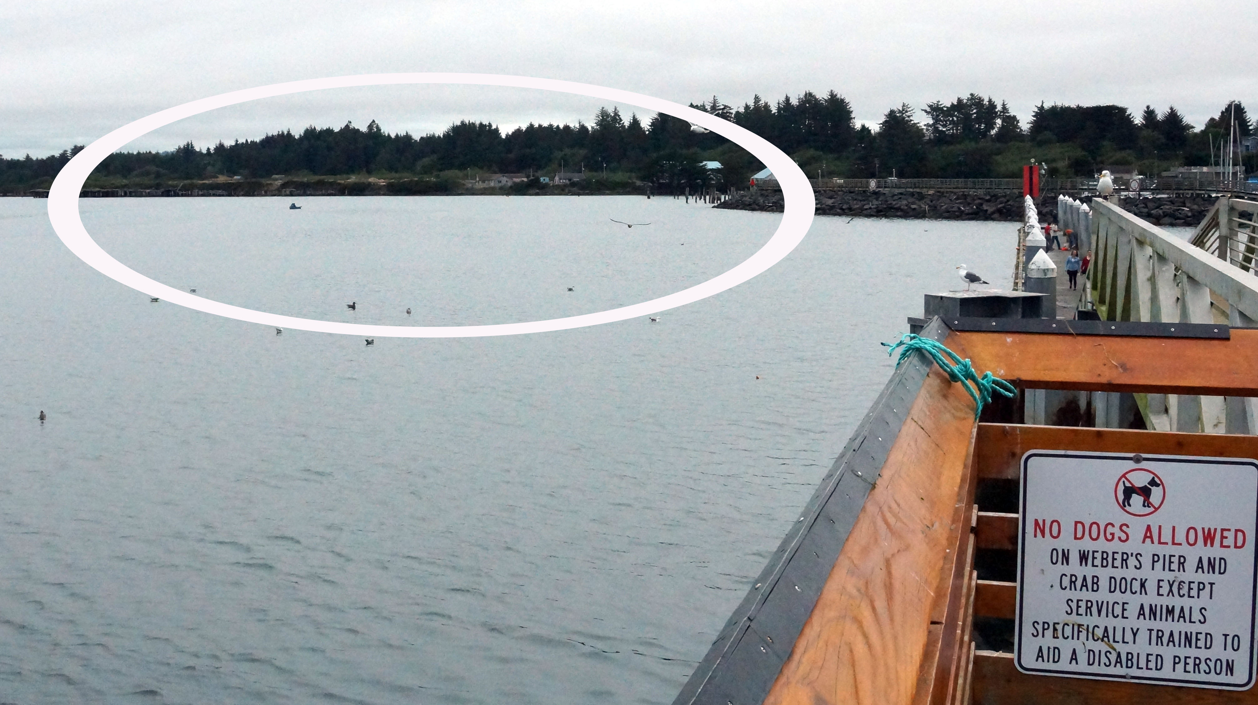
Locations of the buildings above
See more photos and more about Bandon’s history at the site of the Bandon Historical Museum
Tupper Rock
Tupper Rock, also know as Grandmother Rock (by the Coquille Indian Tribe, who considered it sacred), was a huge rock located near the mouth of the Coquille River.
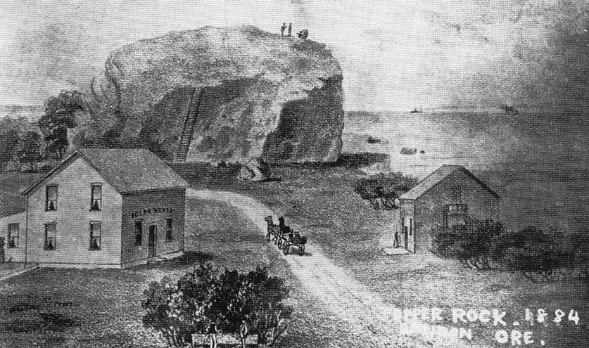
Tupper Rock
The rock itself was blasted to create the jetties that serve to maintain the entrance to the Bandon harbor.
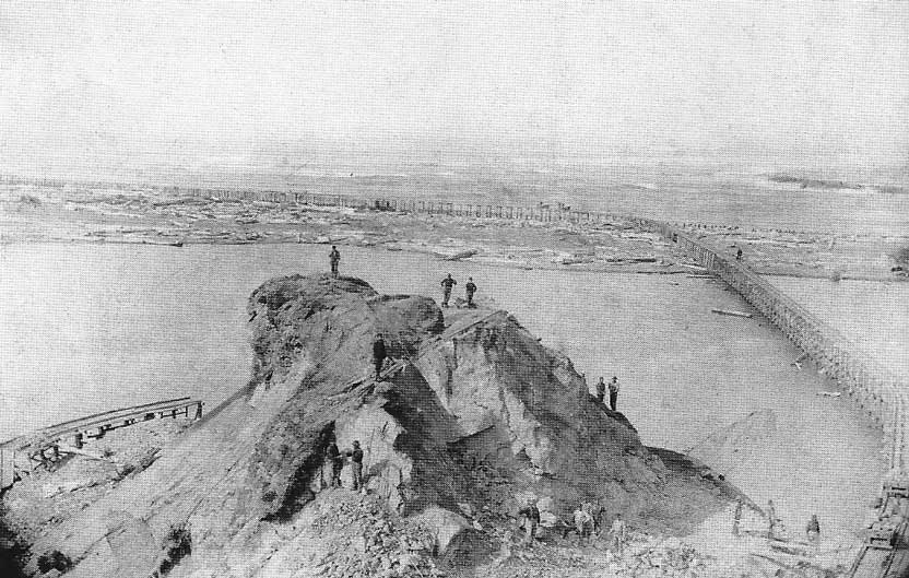
Dismantling Tupper Rock
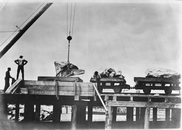
Moving Tupper Rock
Today, the Coquille tribe operates a senior living/assisted care facility on the site.
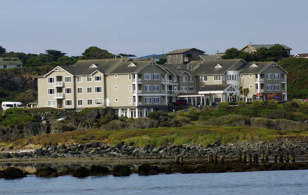
The site of Tupper Rock