Bandon
Notes about Bandon, OR
Monthly Archives: August 2013
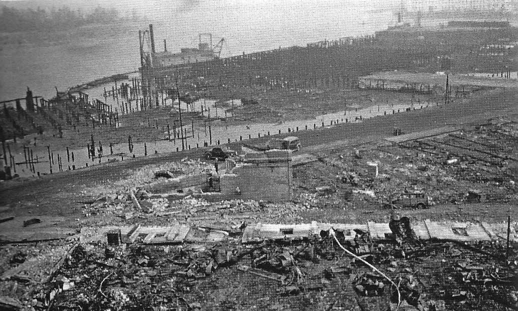
The Bandon Fire, 1936
No one is sure how the 1936 fire started, but the blame for the quick spread is gorse, a shrub that was brought in as an ornamental, but proceeded to spread everywhere…a truly invasive species. What started as a forest fire burning east of town spread quickly when the winds shifted, and when the fire hit the gorse, it was like someone has thrown gasoline on the fire. Flames rose high in the air, and nothing could stop them. Throwing water on it was like throwing water on a grease fire.
By the time the fire burned out, the town was flattened.
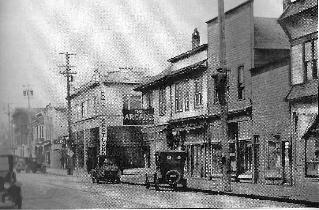
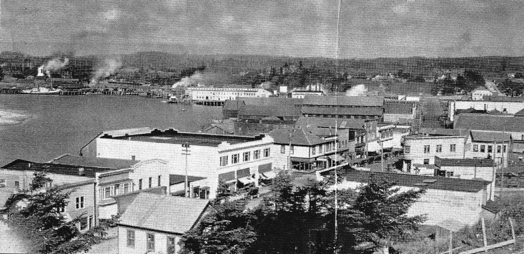
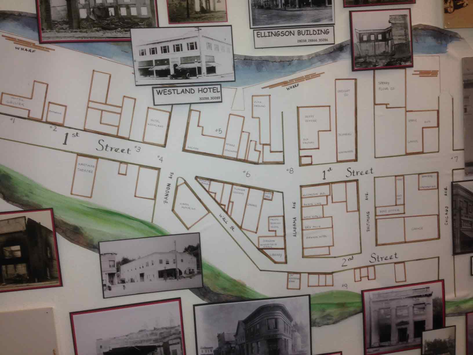
Here are two photos and a map showing buildings before the 1936 fire. The third photo shows the devastation after the fire. (note–all photos will open in a new window when you click on them)
For more information go to the Bandon History Museum Facebook page.
Changes in the Economic Profile of Bandon
Over time, a number of industries have come and gone. These photos show two of those industries, both related to agriculture.
One is a Nestle’s Milk Condensory. It took advantage of the dairy industry. Below is a photo it its early days.(note–all photos will expand to a new tab or window when you click on them)

Nestle Evaporated Milk Condensery
Both the reduction of the dairy industry and the fact that local farmers resisted selling to Nestle caused the business to fail. After that, a number of industries tried to make use the building, but it seems that none were very successful. Eventually, because it was built on pilings that began to rot away, the building had to be demolished. It’s interesting to note that this is one building that survived the great fire of 1936, only to fall victim to other forces.
The full history can be found in the Bandon Western World.

Condensery shortly before demolition
The other industry was the woolen mill. The number of sheep farms in the area provide a large supply of raw materials…for a time. As with the condensery though, the woolen mill wasn’t able to earn enough to survive, and another industry left Bandon.
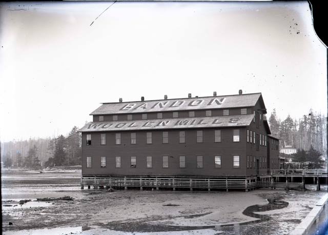
Woolen Mill
This view shows where the buildings above used to be. The waterfront is now fairly clear, but the pilings from the buildings remain.
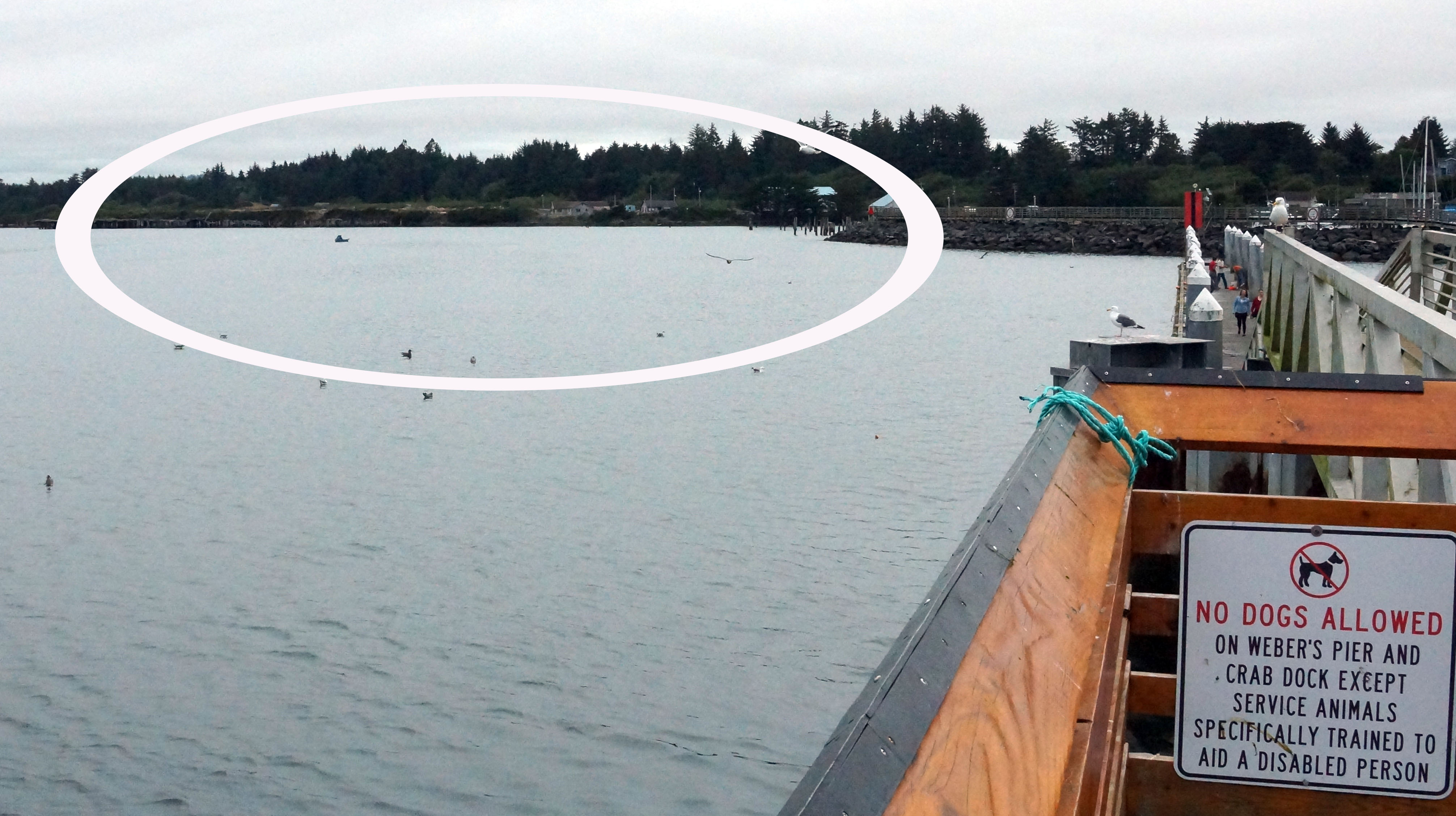
Locations of the buildings above
See more photos and more about Bandon’s history at the site of the Bandon Historical Museum
Using the Guide to Bandon, Oregon
When you first land connect to the guide (found at www.comenius.org/bandon) you will see a map with rather broad detail.
To see a more detailed map for various sections, click on ‘Adjust Level of Detail:’
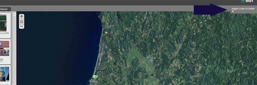
The drop down list will give you choices. For dining and shopping the best level is “Old Town.” For Attractions and ‘Then and Now,’ you might want to start with the overview and drill into areas to zoom.
If an item is ‘off the map’ (not visible in your detail level), it will disappear from the list on the left. That’s why it’s a good idea to always start with the overview.
When you click on an item on the left, it will be identified on the map. The “details’ link will give you more information, but the best thing to do then is to click on the website link (if afailable).
South Jetty
There is a parking area near the South Jetty, and it makes a perfect spot for a beach walk. As you walk along the beach you will see many of the beautiful rock formations that make the Bandon beach one of the most spectacular on the West Coast. At your feet as you walk on the first part of your journey you will see lots of small stones. Look closely and you may find some agates.
As you start the walk along the beach, look at the houses to your left. Those are built on land that wouldn’t be there were it not for the Jetty. The Jetty (along with the North Jetty) changed the course of the Coquille River. The photo below is taken from the East end of the North Jetty, looking across the channel at the South Jetty. (note–clicking on the photo will open an enlarged photo in another window)
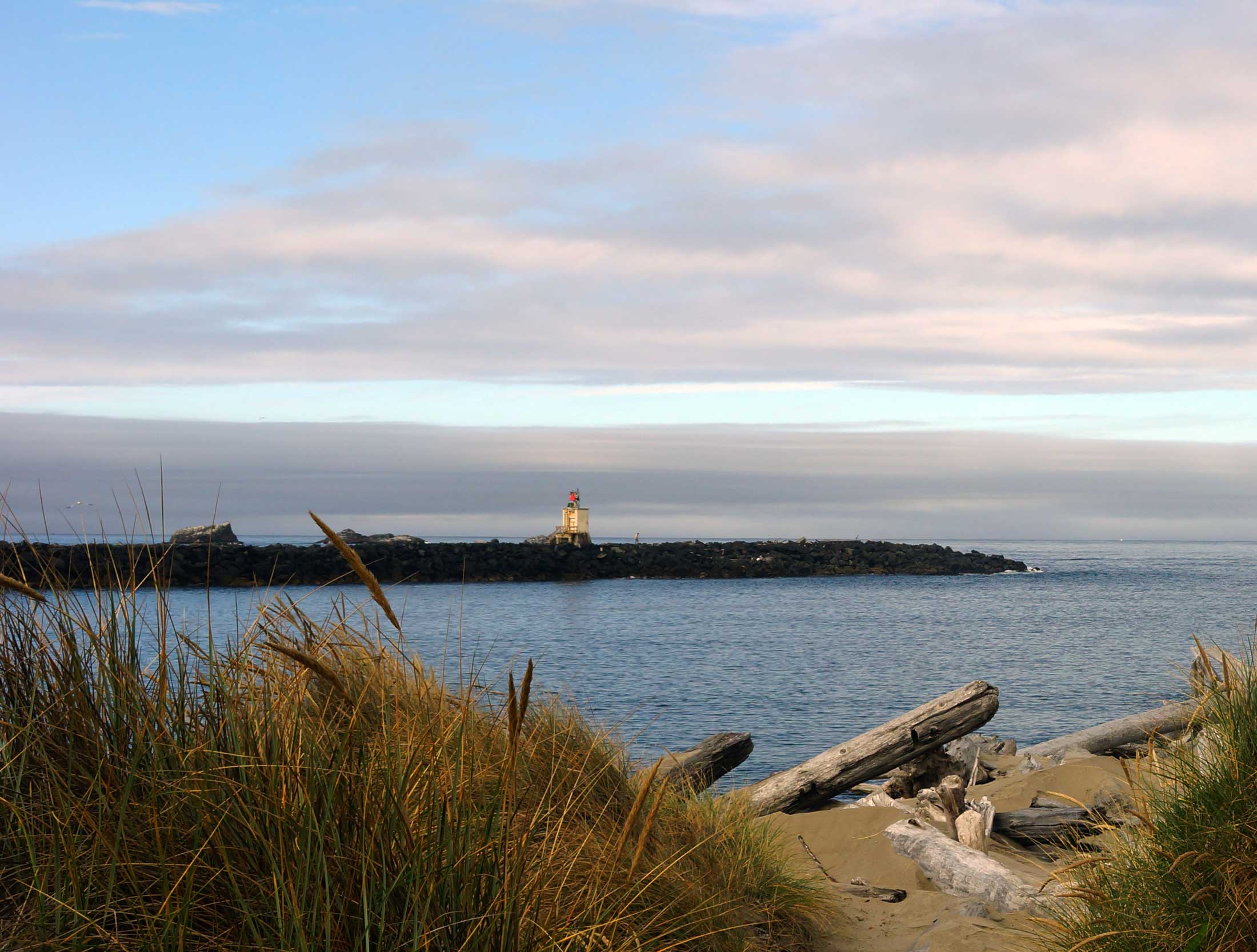
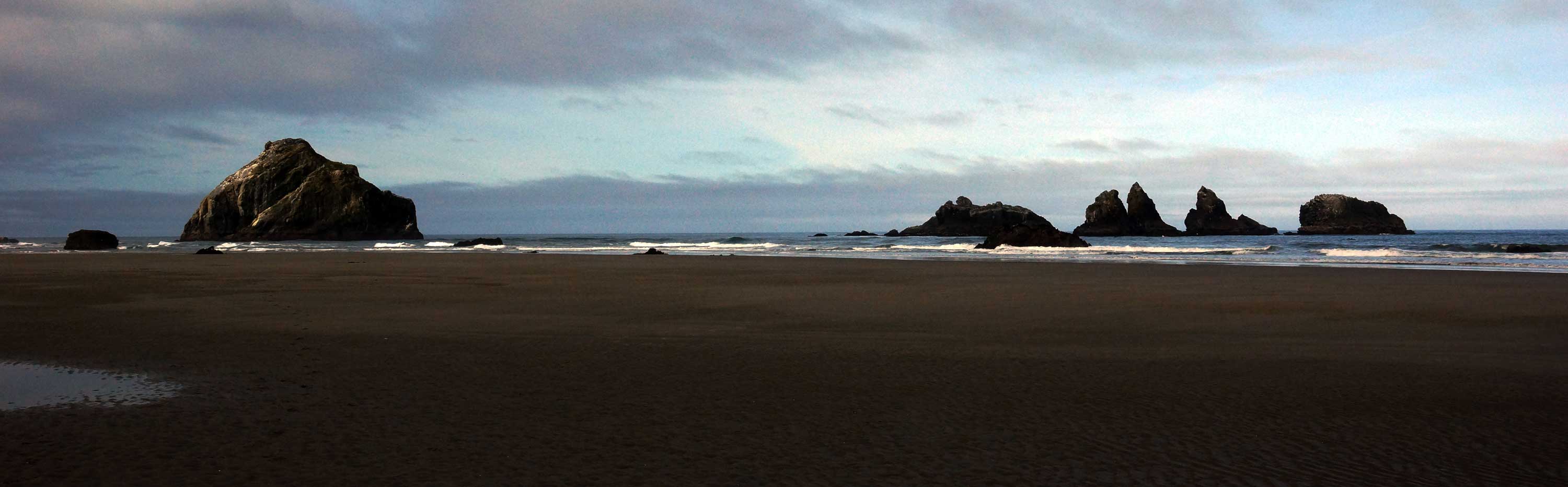
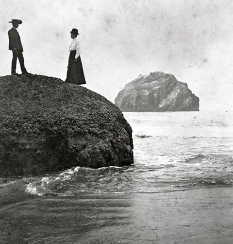
Table Rock
Breeding sea birds nest on these rocks in the spring. Brandt’s, double-crested, and pelagic cormorants, common murres, pigeon guillemots and the ever-present western gulls are among the species that come by the thousands to table rock as well as surrounding rocks.
Also, if you are in the area during a negative low tide there are great opportunities for exploring tide pools.
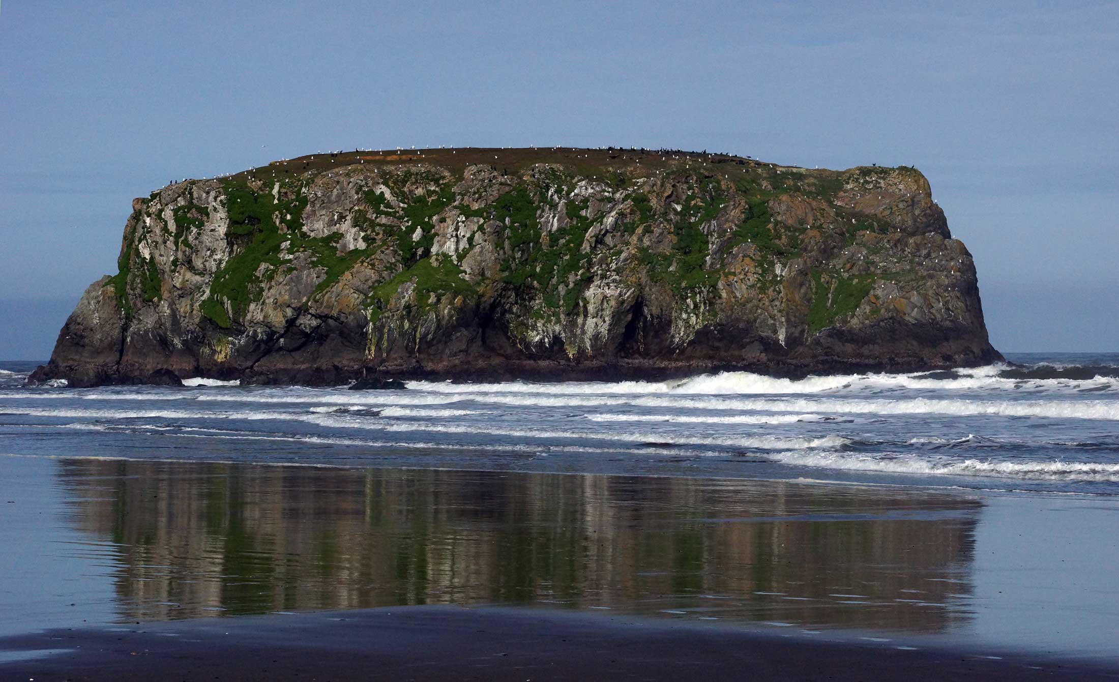
Table Rock
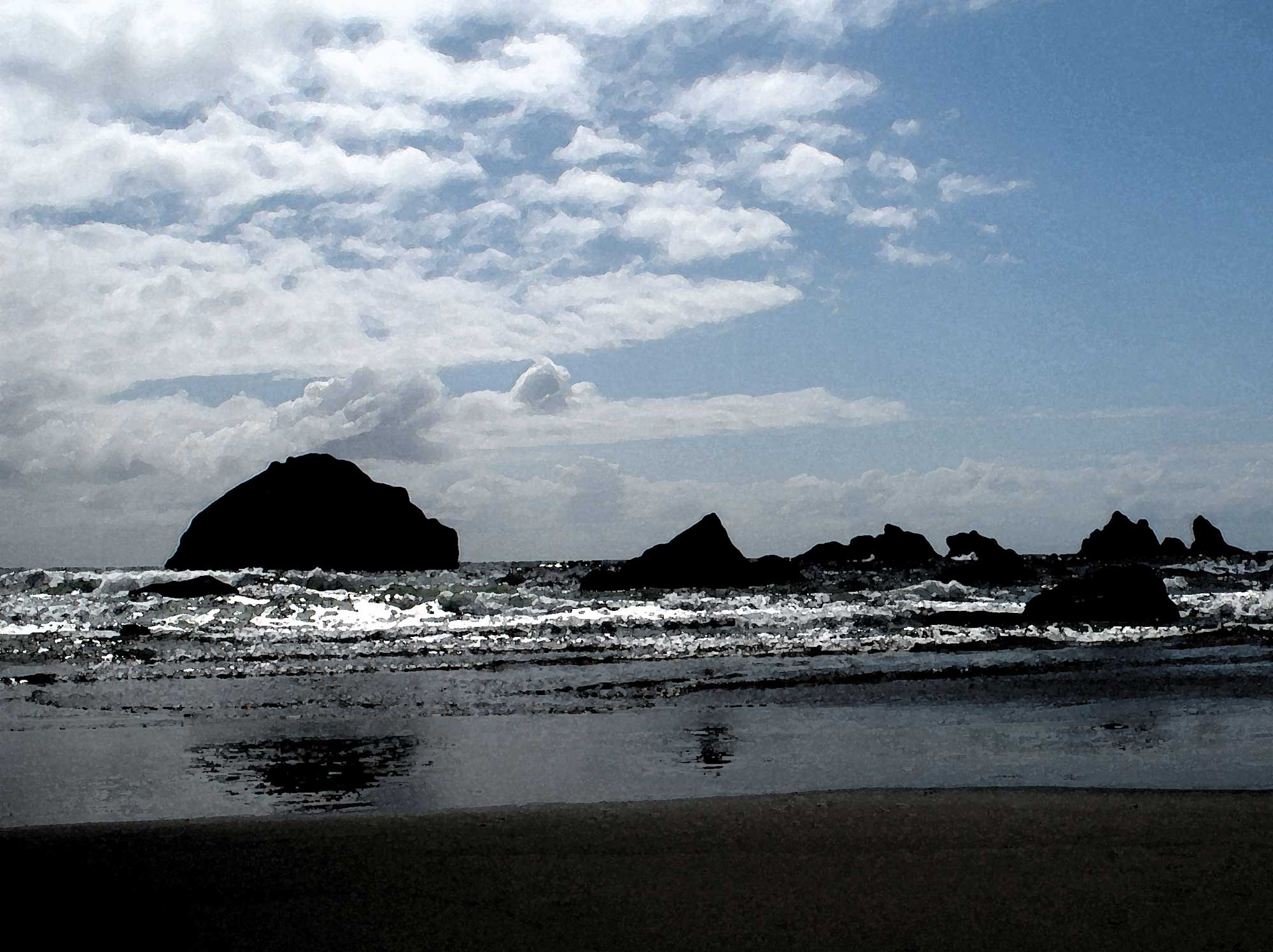
The photo below shows table rock just after sunrise (and before moon set). Table rock is the rock just left of center. At low tide you’ll see a lot of sea stars and anemones on the rocks in the left and right foreground. On a VERY low tide you can get pretty close to table rock.
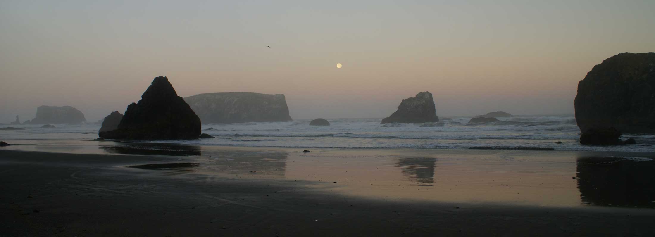
Moon set over table rock
Coquille River Light
The Coquille River light was commissioned in 1895 at the mouth of the Coquille River. It was in continuous operation until 1939, when it was replaced by an automated light on the South Jetty. The original light had a Daboll trumpet as a foghorn (it appears in the photo below). That was replaced in 1910, so it doesn’t appear in the more recent photo below.
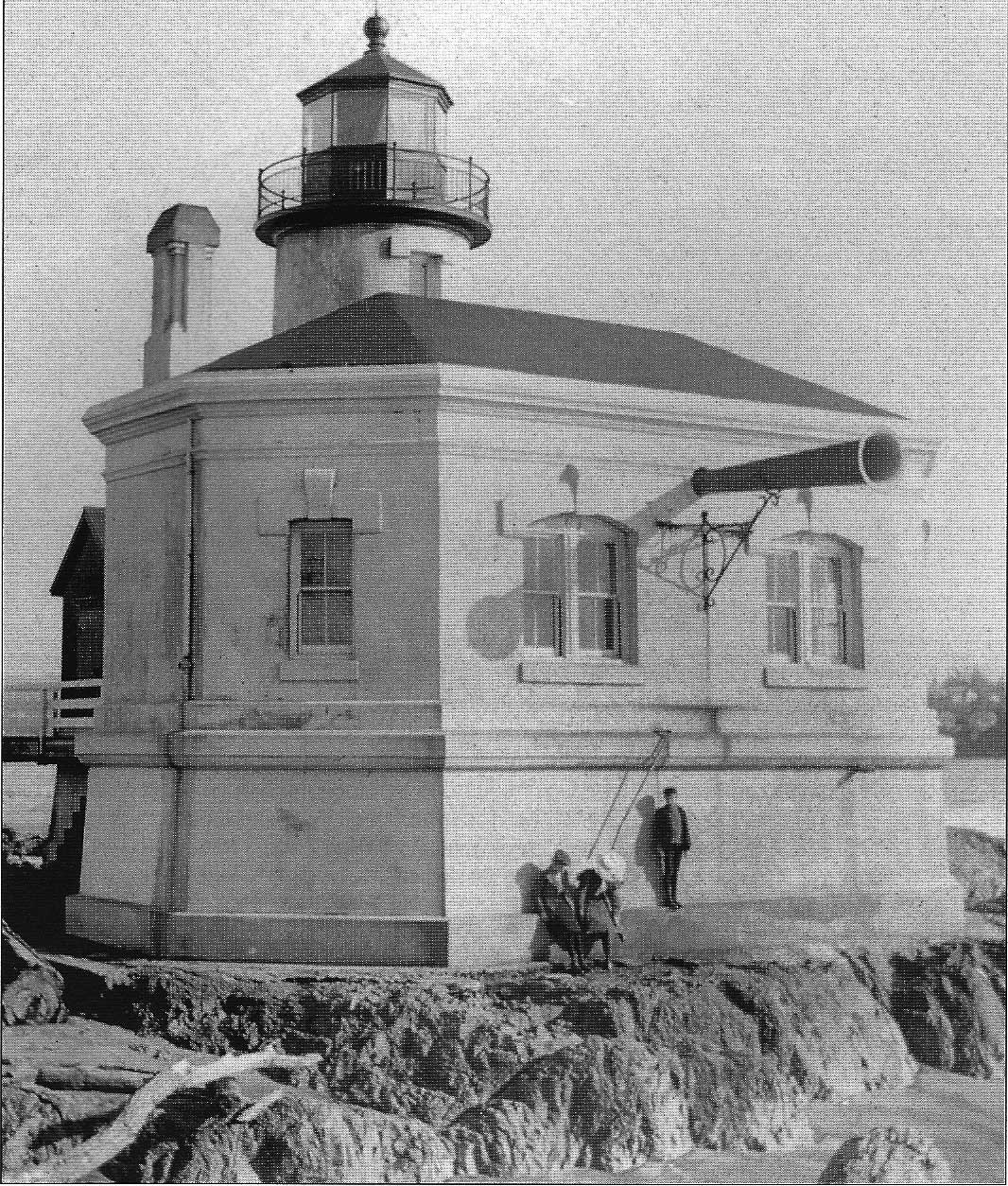
Coquille River Light (pre-1910)
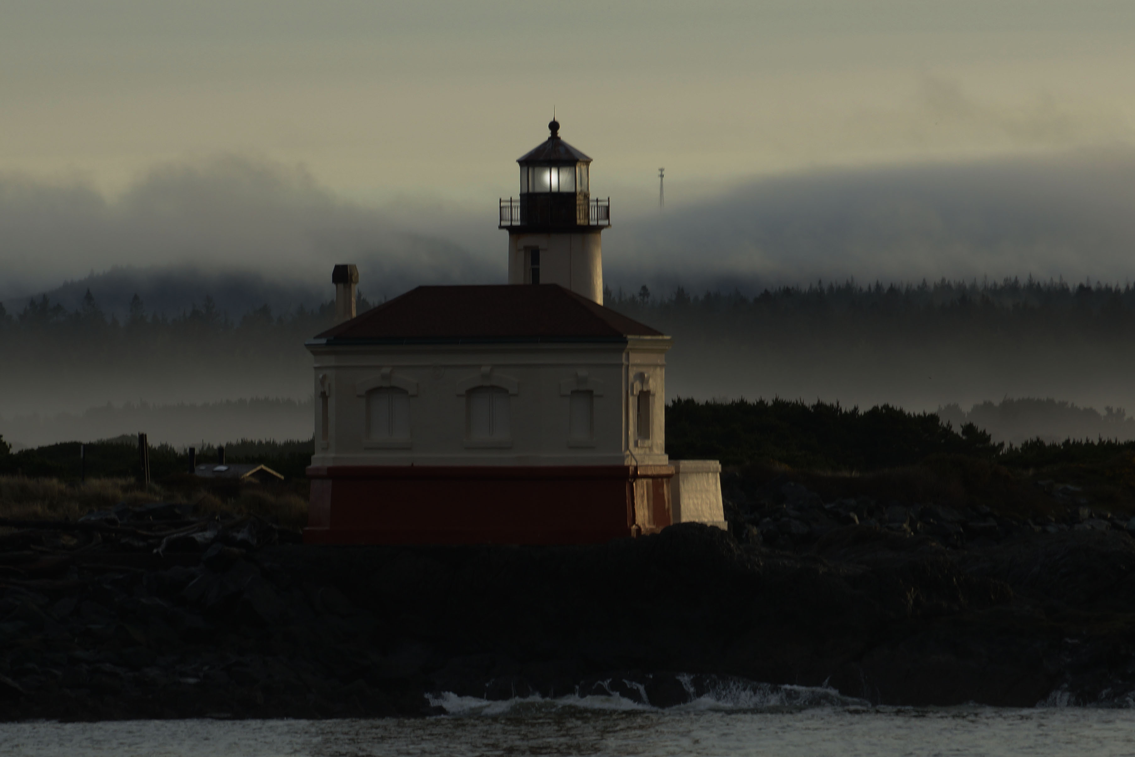
Coquille River Light Today
Elephant Rock
If you travel to the park at Coquille point, you will have a good view of Elephant Rock. This rock is distinguished by two sea caves formed around what appears to be the elephant’s trunk.
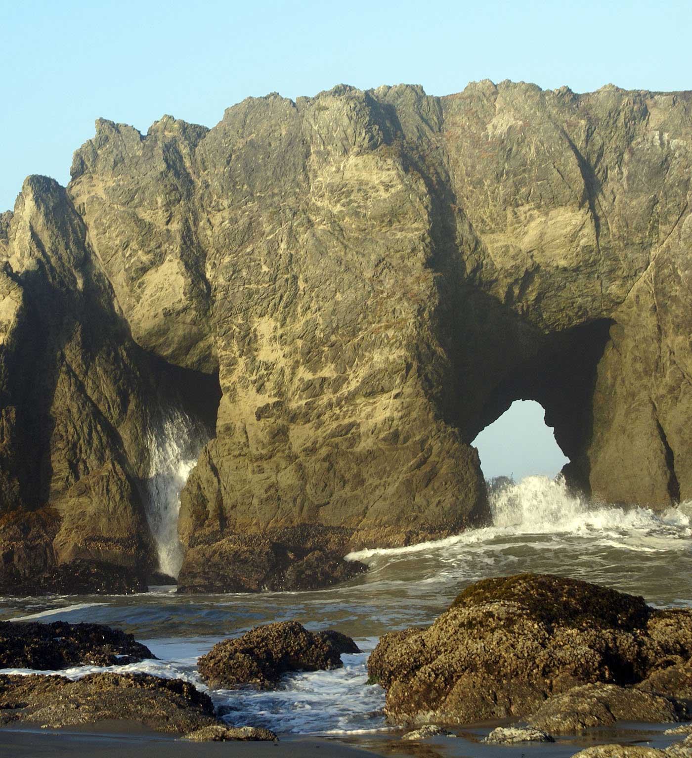
Elephant Rock
The areas of stone above the caves appear to be the ears. During heavy seas (and high tide), water rushes through the caves, and can resemble tusks.
One of the best view points is a short way down the steps leading to the beach.
Tupper Rock
Tupper Rock, also know as Grandmother Rock (by the Coquille Indian Tribe, who considered it sacred), was a huge rock located near the mouth of the Coquille River.
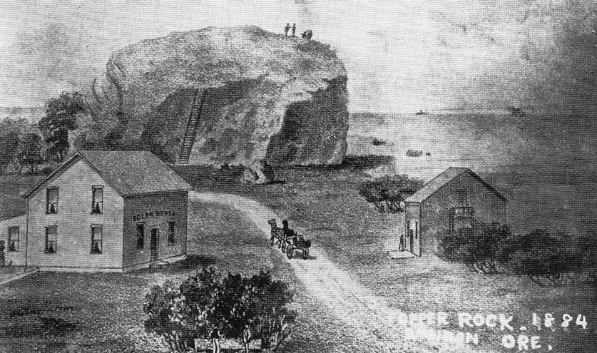
Tupper Rock
The rock itself was blasted to create the jetties that serve to maintain the entrance to the Bandon harbor.
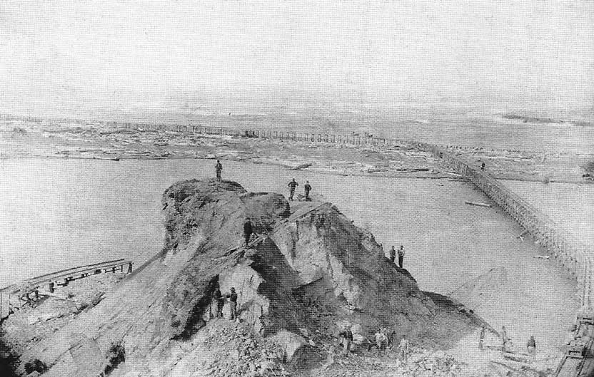
Dismantling Tupper Rock
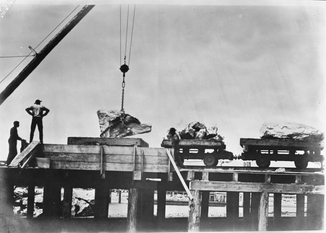
Moving Tupper Rock
Today, the Coquille tribe operates a senior living/assisted care facility on the site.
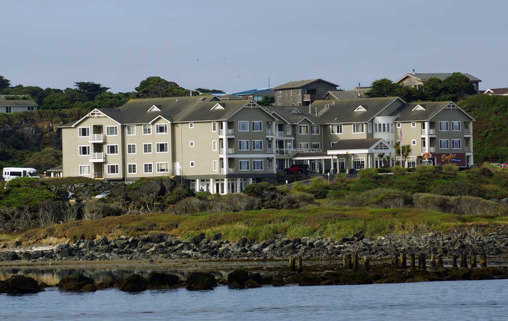
The site of Tupper Rock
View down Alabama Street
This is the view looking South on Alabama Street prior to the fire that destroyed much of Bandon. The building at the end of the street was one of three buildings that survived the fire. At the time it was the bank.
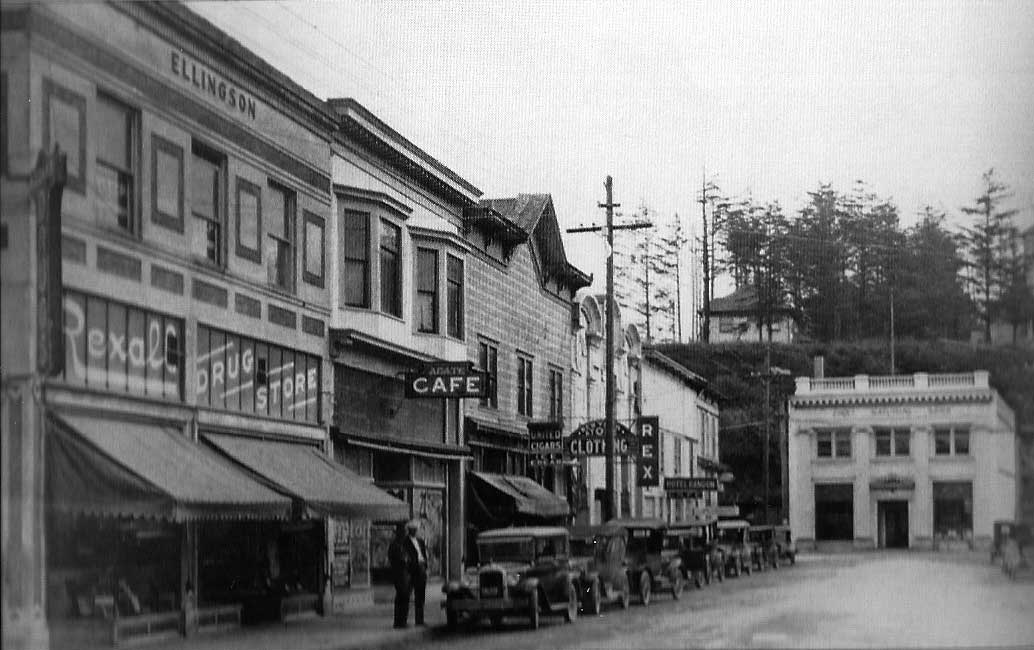
View Down Alabama Street–Pre 1936
The building still stands today. The businesses that were previously along the street are no longer there. There no longer is a drugstore in Old Town. The drugstores (and other stores providing ‘necessities’ for locals) are either ‘uptown,’ or north of town. Old Town has the best eateries, and great specialty stores.
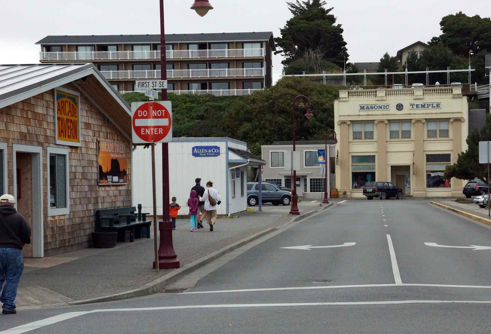
Alabama Street Today